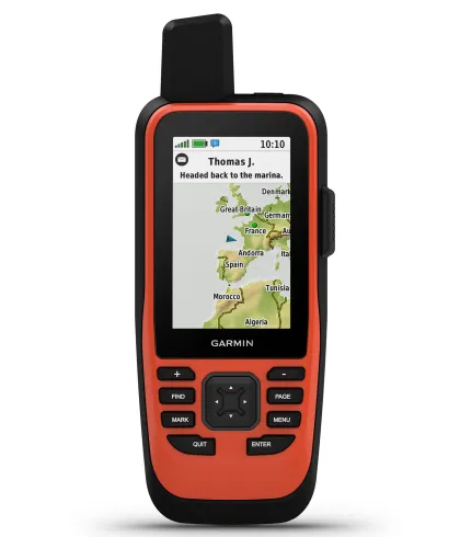


Two-way Messaging
Stay connected with loved ones through text messages, social media posts, or inReach-to-inReach communication, even in remote areas. This feature ensures you can share updates and receive messages without relying on cellphone coverage.
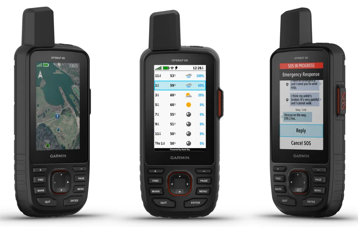
Interactive SOS Alerts
In emergencies, trigger an SOS to the 24/7 Garmin International Emergency Response Coordination Center. This professional service coordinates emergency responses, providing peace of mind during your adventures.
Global Iridium® Satellite Network
The GPSMAP® 66i uses the global Iridium satellite network for reliable communication, ensuring your messages and SOS alerts are delivered anywhere in the world, without the need for cellphone coverage.
InReach Weather Forecast Service
Receive detailed weather updates directly on your device, helping you plan and adapt your journey. Request forecasts for your current location or any waypoint, ensuring you're always prepared for changing conditions.
Built for Adventure
Designed to military standards (MIL-STD-810), the GPSMAP® 66i withstands thermal, shock, and water challenges. It's also compatible with night vision goggles, making it a versatile tool for any expedition.