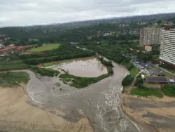
Durban is famous for its iconic beachfront and for being the largest container port in the Southern Hemisphere. However, tucked in a complex river delta with 17 estuaries and exposed to tropical cyclones and heavy rainfall, the eThekwini Municipality constantly battles floods. The problem is exacerbated by climate change, accelerated sea level rise, and human-induced land subsidence.
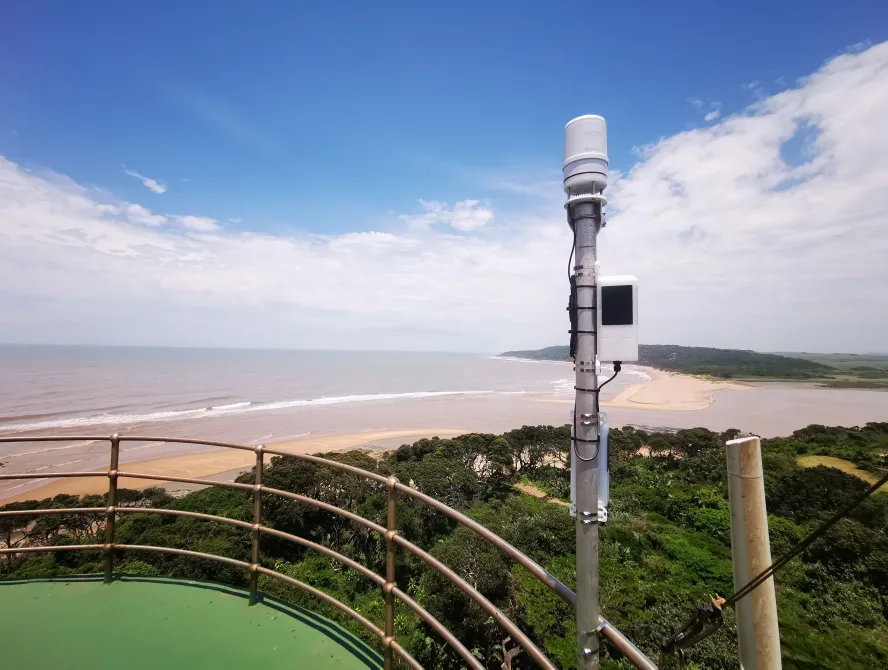
After devastating floods in 2017 and 2019 resulted in massive economic damage, human displacement, and loss of life, the eThekwini initiated a new disaster management strategy to better prepare for future crises. The local government identified the need for real-time environmental observations and forecasts for flood prediction and preparation. They researched the installation and maintenance of a network of weather monitoring stations but faced a few obstacles. First, the existing solutions were too expensive. Second, the available instrumentation was cumbersome and easy to spot—making it vulnerable to theft. Third, available multichannel dataloggers with several wired external sensors weren’t robust enough for a massive disaster management program. Lastly, data were hard to gather and analyze without a centralized portal.
The government considered using point-to-point radio and LORA communication, but both were cost prohibitive and logistically complicated. Also, some flood-prone areas were outside the city or further offshore--making satellite communications imperative.